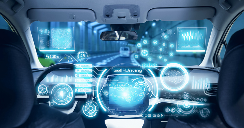
Sensing technology currently in use
When we drive a car, we recognize and assume various factors to ensure safe driving, such as where I am driving, guardrails to the side of the car, traffic signals and signs ahead, and the possibility of a child running into the road.
In other words, we keep taking in various peripheral information and assessing it instantly in order to turn the steering wheel and operate the accelerator and brake appropriately.
Autonomously driven vehicles let machines do all these work, including receipt, acquisition, analytics, analysis, and assessment of such information. The sensing technology is key to achieving the above.
First of all, we have technology that uses cameras and radars to sequentially ascertain vehicles’ peripheral conditions. It must be familiar to many people because there are more vehicles incorporating a camera that monitors what’s ahead, behind and to the sides of the vehicle to support people’s safe driving.
There are also more vehicles equipped with radars. This technology, called active radar, emits electric waves from a car, measures the time taken for them to be reflected on some object and return to the car as well as the direction of reflection, and then analyzes what the object is along with its location.
While radar has the advantage of measurement being possible even under conditions of low visibility, such as when there is fog or it rains at night, it has a drawback in that even though the shape of an object that reflected the radar wave can be found, it is difficult to specifically identify what it is.
To address this issue, the development of technology called sensor fusion, which integrates such information with image information using a camera to identify the objects, is also progressing.
While these sensing technologies are utilized to assist people in driving their cars, enhancing their accuracy and reliability will contribute to realizing autonomous driving using machines.
Another important point is sensing technology called positioning, which is used to know where we are driving in the first place and whether we are heading to the destination for sure.
Positioning satellite system with higher accuracy
Today, many cars are equipped with a car navigation system. This is technology for measuring the position of your car by receiving electric wave signals emitted from artificial satellites used for positioning, which are located 20,000 km above ground.
Although it is generally called GPS, GPS refers to the global positioning system operated by the U.S.
It was originally developed through collaboration between the U.S. air force and naval force and released to the general public as a free service in 1995. Since then, Japan has mainly used this system for positioning information, so similar systems are collectively called GPS.
However, currently, each country launches and operates their own unique positioning systems.
For example, the European system is Galileo, the Russian one is GLONASS, and the Chinese one is BeiDou. These positioning systems used in each country are collectively called Global Navigation Satellite System (GNSS).
Though it was a little late, Japan also launched its first positioning satellite in 2010, following three additional satellites, and now we have a positioning satellite system consisting of four satellites. This is called Michibiki. While the U.S. and Europe are operating over 30 satellites, respectively, just looking at the numbers, Japan is still behind in the area of positioning satellites compared to them.
However, since Japan’s positioning satellites adopt a quasi-zenith satellite system that takes a special orbit so as to be located constantly above the sky of Japan, it has dramatically improved its accuracy when it comes to positioning in Japan.
For example, you may have an experience that your car navigation system displays a different location from where you are actually driving. One of the causes is that you have a bad signal because the positioning satellites are not located high above your car.
In that sense, having more positioning satellites means a higher possibility that any of them is located high above your car, making it easier to maintain the accuracy of positioning.
On the other hand, although Michibiki has only four satellites, it is possible to maintain positioning accuracy because it is a quasi-zenith satellite system. Furthermore, when you drive a car in a location forested with high buildings, if a positioning satellite is located above the sky of the car, it is possible to receive electric waves stably without being blocked by the buildings.
Another cause of worsening positioning accuracy is the error generated as the electric waves from the positioning system progress through the atmosphere. A method for reducing the impact of the error is RTK positioning.
This is a mechanism of receiving electric waves sent from a positioning satellite at a prescribed base station (reference station), calculating the error of the electric waves, and sending information for fixing errors to moving vehicles such as cars that receive electric waves.
In the case of this RTK positioning, if the base station is not close to the car, electric waves containing the same error may not be received. Therefore, communication companies providing this service have deployed base stations compactly across the country and built a system where moving vehicles always receive corrected information from the closest base station.
The provision of such technology and infrastructure limits the margin of error in positioning accuracy to approximately several centimeters. This is extremely important to realize fully autonomous driving, for example.
By combining this with technology such as radar mentioned above, it is possible to drive cars without coming into contact with pedestrians walking along the pavement and enable cars to cross each other even on narrow roads.
To ensure safety, highly precise sensing technology is needed.
For the realization of an exciting future society
But this does not mean the completion of fully autonomous vehicles is a dream only for the future.
For example, with respect to automatic cargo transport using drones, technology in the same transport field, various demonstration experiments have already been carried out. It is already possible to fly safely and automatically ahead of the field of vision of the operator toward a destination, unload the cargo, and return to the original location.
Rulemaking, such as development of laws for sea traffic is progressing as well. Going forward, when practical realization of various flying objects not only drones but also flying vehicles progresses further, the skies will become overcrowded, increasing the danger of collision, etc. If such rulemaking can be concluded, utilization of drones will spread rapidly.
Moreover, as for ground traffic, experimental city-making projects assuming autonomous vehicles are progressing as well. Building infrastructure for ground traffic from scratch can be a rather quick way for autonomous driving traffic.
Society 5.0, a concept of a future society proposed by the Cabinet Office, is aimed at realizing a more comfortable society by exchanging various data between things and people. Fully autonomous vehicles is part of this plan.
For example, as for the development of MaaS (Mobility as a Service) system, which allows you to order unattended buses or taxis to come for you and take you to your destination with only a smartphone, research institutions and companies are working on it not only in Japan but also on a global scale. Sensing technology is key for such next-generation traffic technology.
As people engaged in developing such sensing technology, we are also excited to proceed with our research. We would like you to look forward to the realization of Society 5.0 and support us as well.
When people in the country have such thoughts, it will support research and development, and in my opinion it will be the driving force that accelerates the realization of an exciting future society.
* The information contained herein is current as of May 2023.
* The contents of articles on Meiji.net are based on the personal ideas and opinions of the author and do not indicate the official opinion of Meiji University.
* I work to achieve SDGs related to the educational and research themes that I am currently engaged in.
Information noted in the articles and videos, such as positions and affiliations, are current at the time of production.